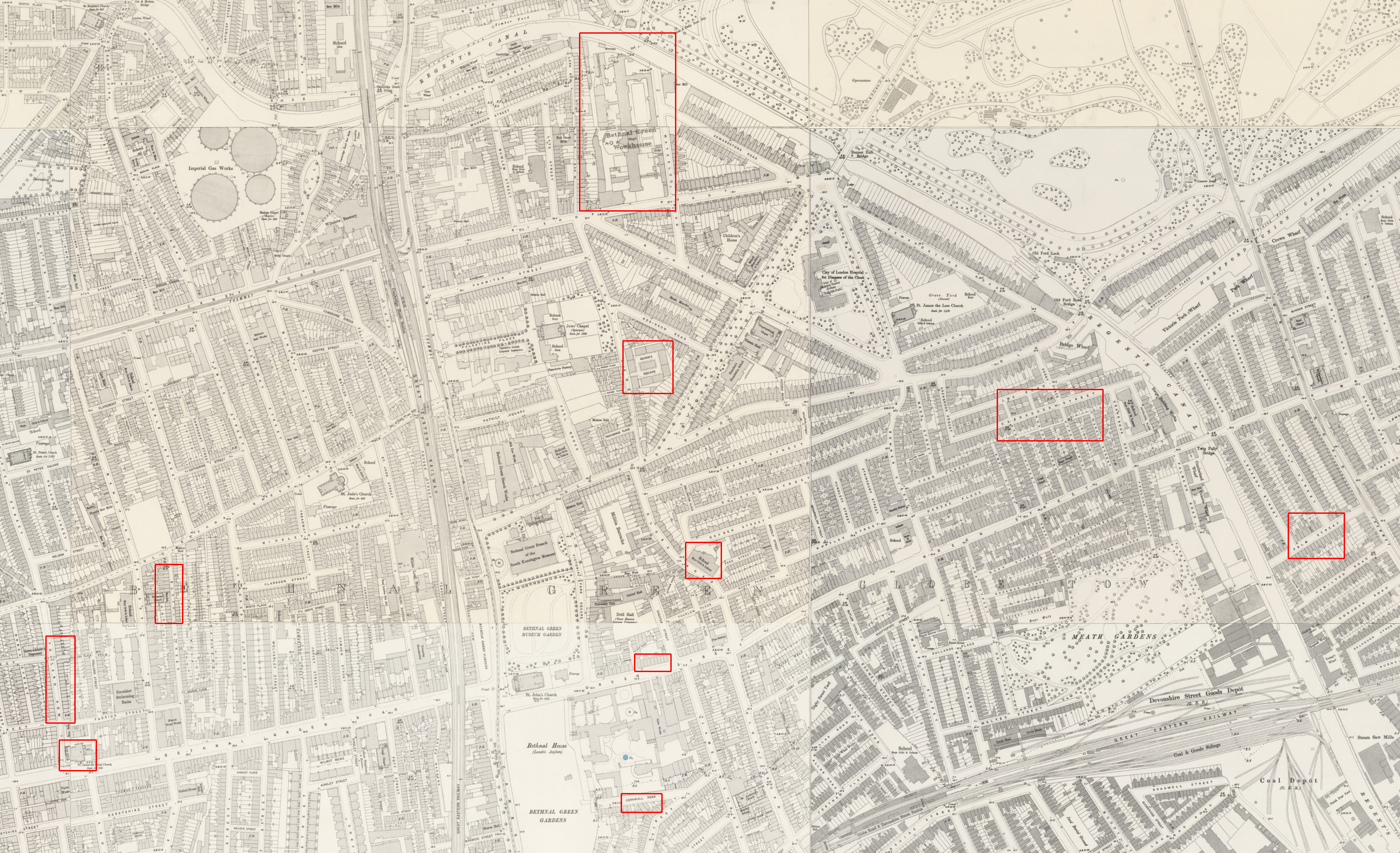
Click on map at left to open and scroll around a larger image
Table below explains highlighted areas and provides links to more detailed maps
Source: National Library of Scotland
Location: London's East End: Bethnal Green
Map Title: Sheet VII.38 - Sheet VII.38
Date(s): Published 1895
Source: http://maps.nls.uk/geo/find/#zoom=16&lat=51.5315&lon=-0.0577&layers=38&point=-0.0552,51.5318
Highlighted areas | |
Left side of map (top to bottom) | |
| Blyth Street | - Sarah Hutchings (mother of Bessie Estall) home 1884-1886 |
| Pollard Row | - Sarah Hutchings home 1881-1883 |
| St. James the Great Church, Bethnal Green Road | - William Estall and Sarah Hutchings marriage in 1891 |
Center of map (top to bottom) | |
| Bethnal Green Workhouse | - Temporary home of Estall family after Sarah Hutchings' death in 1899 |
| Quinn's Buildings, Russia Lane | - Residence of Estall family from at least 1893 to 1899 - Birthplace of Susan (Lillian) Estall (married name Schrotzberger) in 1893 - Residence of family at time of Sarah (Hutchings) Estall's death in 1899 |
| School, Globe Road | - Bessie and her brother Thomas were admitted here in 1895 |
| Museum Buildings, Green Street | - Home of Estall family in 1891 - Birthplace of Bessie Estall (married name Schutze) in 1891 |
| Cornwall Road | - Home of Estall family in 1890 |
Right side of map (top to bottom) | |
| Cranbrook Street | - Henry and Elizabeth (Rice) Estall's (grandparents of Bessie) home in 1861 - Henry was working as a "silk comber" - Boyhood home of William Estall (Bessie's father) - Sarah Hutchings home in 1889 while working as a "fur sewer" |
| Palm Street | - Sarah Hutchings home in 1887 |