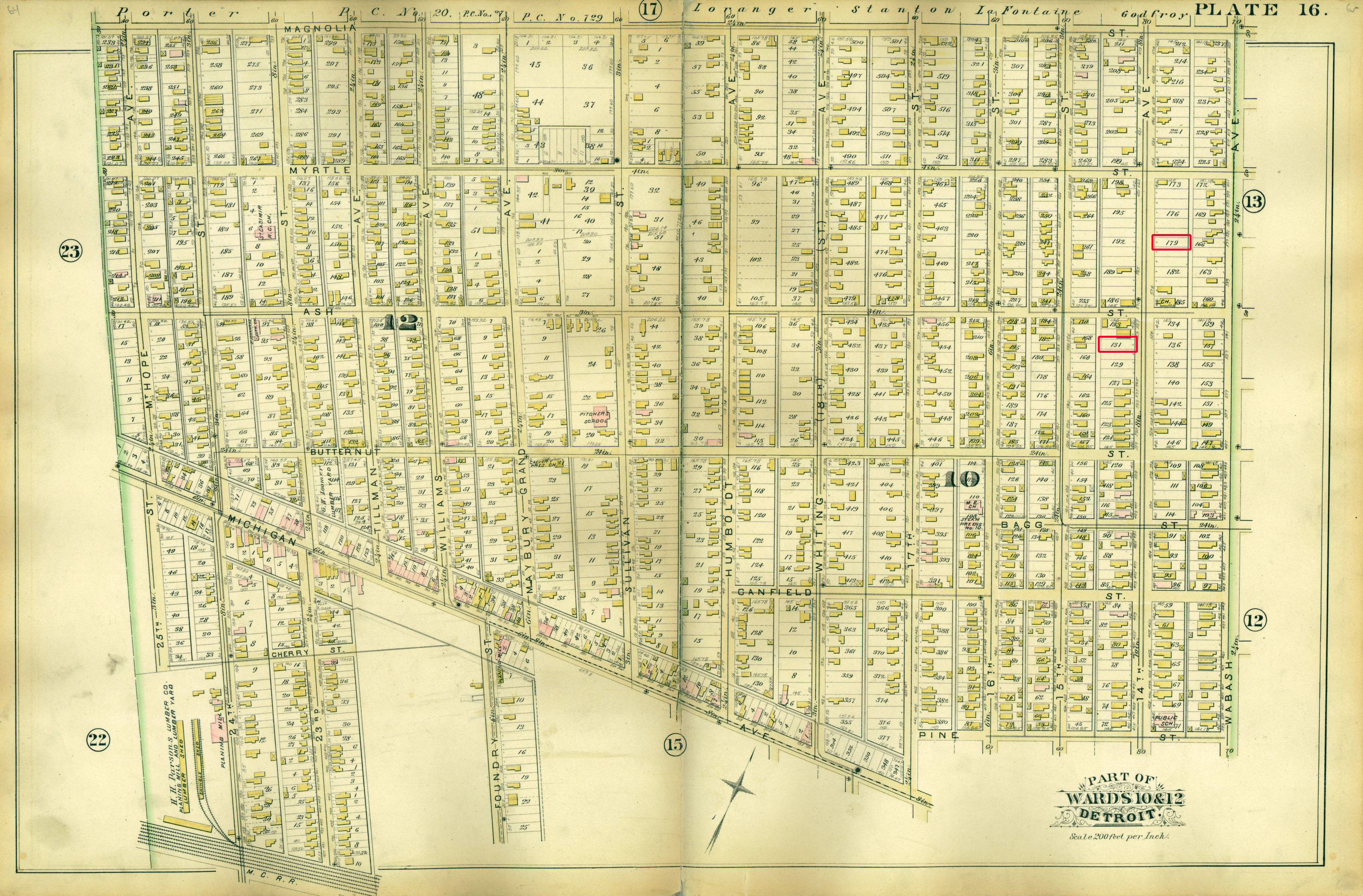
Click on map at left to open and scroll around a larger image
Table below explains highlighted areas and provides links to more detailed maps
Source: Atlas of the City of Detroit and Suburbs (through the University of Michigan Library)
Location: Detroit, Michigan
Map Title: Part of Wards 10 & 12 (Plate 16)
Date(s): 1885
Source: http://quod.lib.umich.edu/m/micounty/3929071.0001.001/68?q1=Wayne+County++Mich.++--+Maps&view=image&size=400
Highlighted areas (top to bottom): | |
| 600 14th Ave | - Lot 179 (undeveloped in 1885) - Home of James Miller McCrie's family from 1886 until his death in 1912 - Home of his widow Anna (Anthony) McCrie until her death in 1928 - Home of their son James Wellington McCrie until 1913 - Home of their daughter Jennie until her death in 1952 - Address was 600 14th Avenue until 1921 when it changed to 3356 14th Avenue |
| 559 14th Ave | - Lot 131 (undeveloped in 1885) - Home of James Wellington McCrie's family from 1914 until his death in 1940 - Home of his widow Sarah (Livingston) McCrie until her death in 1963 - Birthplace of their children William (1914), Margaret (1915), and Jean (1917) McCrie - Marriage place of Jean McCrie and Leonard Schutze in 1941 - Birthplace of Jean and Leonard Schutze's children James (1949) and Sarah (1959) - Residence of Jean and Leonard Schutze until her death in 1970 - Residence of Leonard Schutze until 1973 - Residence (in upper flat) of James and Sarah McCrie's son William McCrie and his wife Greta (Maxwell) and their children - Address was 559 14th Avenue until 1921 when it changed to 3087 14th Avenue |