


The Map Room
Click on a map below to open a new window with the Google annotated map indicated.
When done, close the window tab to return to this page.
Or click on paper maps to open an index of historical paper maps of where our families lived and worked.
Digital Maps
Follow the families as they moved through time and space via Google Maps.
Schutze and Schrotzberger
View Schutze / Schrotzberger History in a larger map
 Schutze/Schrotzberger
McCrie and Livingston
View McCrie / Livingston History in a larger map
 McCrie/Livingston

Bartlett and Brown
View Bartlett / Brown History in a larger map
 Bartlett/Brown
Ehrlich and Parker
View Ehrlich / Parker History in a larger map
 Ehrlich/Parker
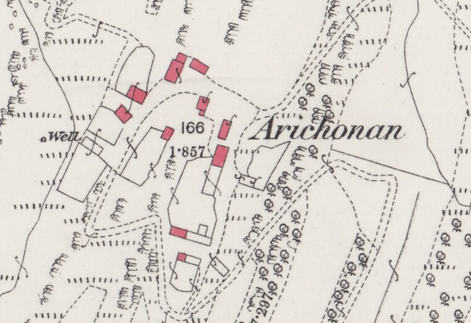
Paper Maps
See where the families lived on maps published about the time they lived there.
Click here or on the map image below to open the page of "paper" maps from historical times.